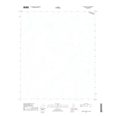
2018 Map of Tinajas Altas OE S
USGS Topo · Published 2018About this map
The international boundary between the United States and Mexico defines the northern edge of this arid landscape, where the USA E U Mexicanos border line cuts across the desert terrain. This map captures a strictly natural environment dominated by a complex network of dry washes and desert drainages. These hydrologic features create a delicate pattern across the sheet, illustrating how water moves through the basin during rare precipitation events. In this specific region, the absence of human settlements, roads, or structures highlights the environmental isolation at the southern reaches of the Yuma County desert, preserving the character of the land exactly as it was surveyed in the late 2010s.
Find a feature on this map
1 named feature on this map. Tap any name to fly to it.
Don’t see what you’re looking for? This feature index may not catch every label — zoom into the map to look around manually.
Map Details
Editions of this 2018 Tinajas Altas OE S Map
This is the sole edition of this map. No revisions or reprints were ever made.
Other maps of this area
1942 · Yuma
USGS Topo · 1:250,000

1953 · Ajo
USGS Topo · 1:250,000
1954 · El Centro
USGS Topo · 1:250,000
1955 · El Centro
USGS Topo · 1:250,000

1957 · Ajo
USGS Topo · 1:250,000

1958 · Ajo
USGS Topo · 1:250,000
1958 · El Centro
USGS Topo · 1:250,000
1961 · El Centro
USGS Topo · 1:250,000

1962 · Ajo
USGS Topo · 1:250,000

1963 · Ajo
USGS Topo · 1:250,000