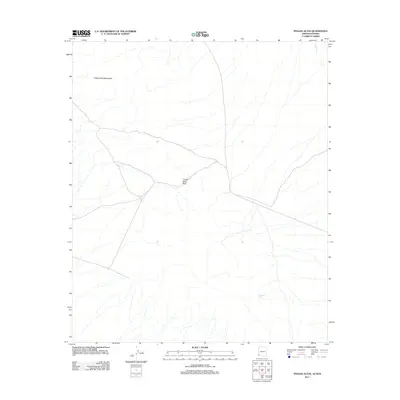
2011 Map of Tinajas Altas
USGS Topo · Published 2011About this map
The Tinajas Altas Mountains dominate this arid landscape on the border of Arizona and Sonora, Mexico. This environment is characterized by critical desert water sources and natural transit corridors, most notably the Tinajas Altas rock tanks which have historically served as a vital life-sustaining resource in one of North America's driest regions. The topography centers on the Tinajas Altas Pass, a strategic gap in the granite range that has funneled travelers and migrants through the desert for centuries. Drainage patterns like Coyote Wash and isolated features such as Surveyors Tank further define the hydrology of this remote borderland territory.
Find a feature on this map
5 named features on this map. Tap any name to fly to it.
Don’t see what you’re looking for? This feature index may not catch every label — zoom into the map to look around manually.
Map Details
Editions of this 2011 Tinajas Altas Map
This is the sole edition of this map. No revisions or reprints were ever made.
Other maps of this area
1942 · Yuma
USGS Topo · 1:250,000

1953 · Ajo
USGS Topo · 1:250,000
1954 · El Centro
USGS Topo · 1:250,000
1955 · El Centro
USGS Topo · 1:250,000

1957 · Ajo
USGS Topo · 1:250,000

1958 · Ajo
USGS Topo · 1:250,000
1958 · El Centro
USGS Topo · 1:250,000
1961 · El Centro
USGS Topo · 1:250,000

1962 · Ajo
USGS Topo · 1:250,000

1963 · Ajo
USGS Topo · 1:250,000