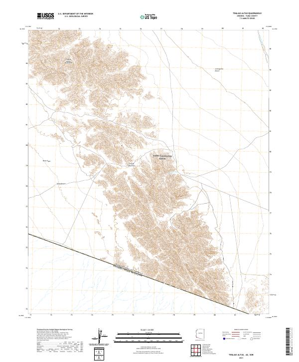
2021 Map of Tinajas Altas
USGS Topo · Published 2021About this map
The Tinajas Altas Mountains dominate this borderland landscape, where the jagged peaks meet the sweeping expanse of the Lechuguilla Desert and the Yuma Desert. This modern survey documents a critical junction of geography and history along the international boundary, capturing the stark transition from the mountain slopes to the open flats of Davis Plain. Central to the area's significance is the Tinajas Altas Pass and the eponymous Tinajas Altas water source, a legendary stop for travelers in this arid region for centuries. The map details the drainage patterns of Coyote Wash and the complex topography that historically dictated the routes of travel across the Sonoran landscape before reaching the southern international line.
Find a feature on this map
12 named features on this map. Tap any name to fly to it.
Don’t see what you’re looking for? This feature index may not catch every label — zoom into the map to look around manually.
Map Details
Editions of this 2021 Tinajas Altas Map
This is the sole edition of this map. No revisions or reprints were ever made.
Other maps of this area

1942 · Yuma
USGS Topo · 1:250,000

1953 · Ajo
USGS Topo · 1:250,000

1954 · El Centro
USGS Topo · 1:250,000

1955 · El Centro
USGS Topo · 1:250,000

1957 · Ajo
USGS Topo · 1:250,000

1958 · Ajo
USGS Topo · 1:250,000

1958 · El Centro
USGS Topo · 1:250,000

1961 · El Centro
USGS Topo · 1:250,000

1962 · Ajo
USGS Topo · 1:250,000

1963 · Ajo
USGS Topo · 1:250,000