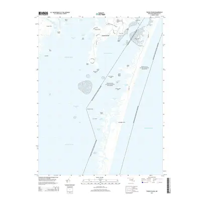
2014 Map of Tingles Island
USGS Topo · Published 2014About this map
The coastal marshlands and barrier islands of Worcester County are defined by the expansive Assateague Island National Seashore, which stretches along the Atlantic coast. This landscape is a complex network of shallow bays and tidal inlets, including Sinepuxent Bay and Chincoteague Bay, separated by the thin ribbon of Assateague Island. Inland, the community of Newport South sits near several necks of land, such as Newport Neck and Peters Neck, that reach into the surrounding waters.
Find a feature on this map
48 named features on this map. Tap any name to fly to it.
Don’t see what you’re looking for? This feature index may not catch every label — zoom into the map to look around manually.
Map Details
Editions of this 2014 Tingles Island Map
This is the sole edition of this map. No revisions or reprints were ever made.
Other maps of this area

1901 · Snow Hill
USGS Topo · 1:62,500

1901 · Green Run
USGS Topo · 1:62,500

1901 · Ocean City
USGS Topo · 1:62,500

1902 · Pittsville
USGS Topo · 1:62,500

1938 · Green Run
USGS Topo · 1:62,500

1942 · Ocean City
USGS Topo · 1:62,500

1942 · Ninepin
USGS Topo · 1:24,000

1942 · Ocean City
USGS Topo · 1:24,000

1942 · Tingles Island
USGS Topo · 1:24,000

1942 · Wesley
USGS Topo · 1:24,000