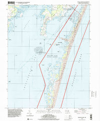
1998 Map of Tingles Island
USGS Topo · Published 2000About this map
Stephen Decatur Memorial Neck and Newport Neck dominate the western portion of this coastal landscape, illustrating the intricate network of coves and points that define the Worcester County shoreline. The map documents the barrier island system at the close of the 20th century, where the Assateague Island National Seashore and Assateague Island State Park protect the delicate environment of Assateague Island.
Find a feature on this map
39 named features on this map. Tap any name to fly to it.
Don’t see what you’re looking for? This feature index may not catch every label — zoom into the map to look around manually.
Map Details
Editions of this 1998 Tingles Island Map
This is the sole edition of this map. No revisions or reprints were ever made.
Other maps of this area

1901 · Snow Hill
USGS Topo · 1:62,500

1901 · Green Run
USGS Topo · 1:62,500

1901 · Ocean City
USGS Topo · 1:62,500

1902 · Pittsville
USGS Topo · 1:62,500

1938 · Green Run
USGS Topo · 1:62,500

1942 · Ocean City
USGS Topo · 1:62,500

1942 · Ninepin
USGS Topo · 1:24,000

1942 · Ocean City
USGS Topo · 1:24,000

1942 · Tingles Island
USGS Topo · 1:24,000

1942 · Wesley
USGS Topo · 1:24,000