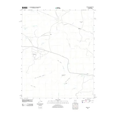
2010 Map of Tinian
USGS Topo · Published 2010About this map
Tinian and the Torreon Trading Post serve as the primary landmarks in this high-desert region of the Eastern Navajo Agency. The landscape is defined by vast mesas and seasonal drainages, including the prominent Chaco Mesa and Mesa de San Felipe, which rise above the surrounding flats. A complex network of Bureau of Indian Affairs roads, such as Indian Service Route 473 and Indian Service Route 91, connects these remote settlements and provides access across the arid terrain.
Find a feature on this map
29 named features on this map. Tap any name to fly to it.
Don’t see what you’re looking for? This feature index may not catch every label — zoom into the map to look around manually.
Map Details
Editions of this 2010 Tinian Map
This is the sole edition of this map. No revisions or reprints were ever made.
Other maps of this area
1883 · Mt. Taylor
USGS Topo · 1:250,000
1886 · Mt. Taylor
USGS Topo · 1:250,000
1892 · Mt. Taylor
USGS Topo · 1:250,000
1899 · Mt. Taylor
USGS Topo · 1:250,000
1958 · Albuquerque
USGS Topo · 1:250,000
1961 · Ojo Encino Mesa
USGS Topo · 1:24,000
1961 · Johnson Trading Post
USGS Topo · 1:24,000
1961 · Star Lake
USGS Topo · 1:24,000
1961 · Mesita Del Gavilan
USGS Topo · 1:24,000
1961 · Arroyo Empedrado
USGS Topo · 1:24,000
Featured Places
- Eastern Navajo Agency, NM
- Tinian, Eastern Navajo Agency
- Sandoval County, NM
- McKinley County, NM
- United States