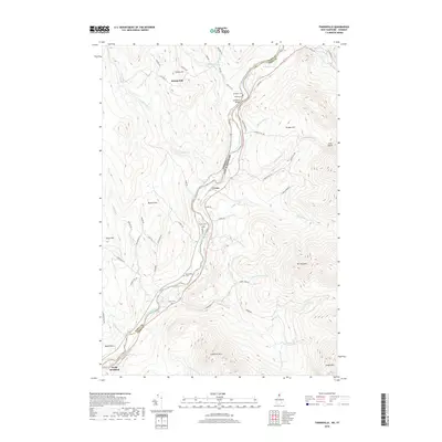
2018 Map of Tinkerville
USGS Topo · Published 2018About this map
The Connecticut River serves as the dividing line between Coos County, New Hampshire, and Essex County, Vermont, in this 2018 study. Small riverbank settlements and farming clusters are connected by a network of rural roads that navigate the dramatic elevation changes of the White Mountains and Northeast Kingdom foothills. Notable hubs include Columbia Bridge and Bloomfield, while North Stratford anchors the southwestern corner of the quadrangle. High ground is defined by prominent peaks such as Lightning Mtn and Mt Pleasant. For genealogists and local historians, the landscape is dotted with small family and community burial grounds, including Blodgett Cem, O'Neil Cem, and Healey Cem, which remain as markers of the area's early families. The numerous tributaries, such as Schoolhouse Brook and Roaring Brook, suggest a landscape historically shaped by timber and water power.
Find a feature on this map
67 named features on this map. Tap any name to fly to it.
Don’t see what you’re looking for? This feature index may not catch every label — zoom into the map to look around manually.
Map Details
Editions of this 2018 Tinkerville Map
This is the sole edition of this map. No revisions or reprints were ever made.
Other maps of this area

1920 · Guildhall
USGS Topo · 1:62,500

1929 · Averill
USGS Topo · 1:62,500

1930 · Percy
USGS Topo · 1:62,500

1930 · Dixville
USGS Topo · 1:62,500

1931 · Guildhall
USGS Topo · 1:48,000

1933 · Guildhall
USGS Topo · 1:48,000

1933 · Dixville
USGS Topo · 1:62,500

1934 · Percy
USGS Topo · 1:62,500

1934 · Dixville
USGS Topo · 1:62,500

1937 · Guildhall
USGS Topo · 1:62,500