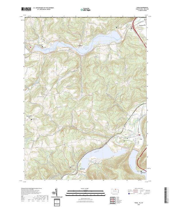
2023 Map of Tioga
USGS Topo · Published 2023About this map
Cowanesque Lake and the Hammond Dam define the central landscape of this northern Pennsylvania quadrangle, where the Cowanesque River and Crooked Creek valleys have been transformed for modern flood control and recreation. The map details the small borough of Tioga near the confluence of the Tioga River, alongside other historic communities like Lawrenceville, Nelson, and Hammond. Traces of the region's older transport networks remain visible, such as the Railroad Grade Trail - Ives Run Trl and the high-speed Appalachian Throughway cutting through the valley. For those researching local lineages, several burial grounds are scattered across the hills and valley floors, including Evergreen Cem, Cady Cem, and Dailey Cem. The long-distance Mid-State Trl winds through the terrain, connecting Gee Hollow and Tompkins with the elevated ridges of Farmington Hill.
Find a feature on this map
79 named features on this map. Tap any name to fly to it.
Don’t see what you’re looking for? This feature index may not catch every label — zoom into the map to look around manually.
Map Details
Editions of this 2023 Tioga Map
This is the sole edition of this map. No revisions or reprints were ever made.
Other maps of this area

1900 · Tioga
USGS Topo · 1:62,500

1900 · Elkland
USGS Topo · 1:62,500

1902 · Tioga
USGS Topo · 1:62,500

1914 · Corning
USGS Topo · 1:62,500

1924 · Woodhull
USGS Topo · 1:48,000

1926 · Woodhull
USGS Topo · 1:62,500

1944 · Woodhull
USGS Topo · 1:62,500

1944 · Corning
USGS Topo · 1:62,500

1950 · Elmira
USGS Topo · 1:250,000
1953 · Borden
USGS Topo · 1:24,000