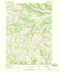
1953 Map of Borden
USGS Topo · Published 1955About this map
The Canisteo River and Tuscarora Creek valleys define this mid-century portrait of southern Steuben County, where the Erie RR and Baltimore and Ohio RR cut through the upland terrain. The landscape is marked by a dense network of rural infrastructure, including numerous one-room schoolhouses like Williams Sch and Hurd Sch, alongside family-named landmarks such as Hardscrabble Hill and Earl Beatty Hill. Small settlements such as Derby Switch and South Addison are situated along the river and rail corridors, while the southern margin follows the New York-Pennsylvania Boundary Line. This topography reflects the transition from valley-floor rail commerce to high-ground farming and timber, evidenced by the scattered locations of Elk Creek Cem and Swart Cem among the ridges of Symonds Hill and Mutton Hill.
Find a feature on this map
49 named features on this map. Tap any name to fly to it.
Don’t see what you’re looking for? This feature index may not catch every label — zoom into the map to look around manually.
Map Details
Editions of this 1953 Borden Map
Other maps of this area

1900 · Tioga
USGS Topo · 1:62,500

1900 · Elkland
USGS Topo · 1:62,500

1902 · Tioga
USGS Topo · 1:62,500

1914 · Corning
USGS Topo · 1:62,500

1924 · Woodhull
USGS Topo · 1:48,000

1926 · Woodhull
USGS Topo · 1:62,500

1944 · Woodhull
USGS Topo · 1:62,500

1944 · Corning
USGS Topo · 1:62,500

1950 · Elmira
USGS Topo · 1:250,000

1953 · Campbell
USGS Topo · 1:24,000