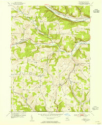
1953 Map of Borden
USGS Topo · Published 1970About this map
The Canisteo River corridor and the high ground of the New York-Pennsylvania Boundary Line define this mid-century portrait of southern Steuben County. The landscape is characterized by its rural infrastructure, featuring a dense network of country schools such as Symonds Hill Sch and Hurd Sch that served dispersed farming families. Transportation is anchored by the Erie RR and the Baltimore and Ohio RR, which intersect the terrain alongside the prominent Liberty Highway. Local landmarks like the Woodhull Radio Tower and the Gaging Sta on Tuscarora Creek offer specific points of reference for researchers tracing the 1950s utility and transit patterns. Small rural hubs like Derby Switch and Freeman appear alongside family-named elevations including Addison Hill and Mutton Hill, providing a detailed look at the region's topography and settlement history.
Find a feature on this map
39 named features on this map. Tap any name to fly to it.
Don’t see what you’re looking for? This feature index may not catch every label — zoom into the map to look around manually.
Map Details
Editions of this 1953 Borden Map
Other maps of this area

1900 · Tioga
USGS Topo · 1:62,500

1900 · Elkland
USGS Topo · 1:62,500

1902 · Tioga
USGS Topo · 1:62,500

1914 · Corning
USGS Topo · 1:62,500

1924 · Woodhull
USGS Topo · 1:48,000

1926 · Woodhull
USGS Topo · 1:62,500

1944 · Woodhull
USGS Topo · 1:62,500

1944 · Corning
USGS Topo · 1:62,500

1950 · Elmira
USGS Topo · 1:250,000

1953 · Campbell
USGS Topo · 1:24,000