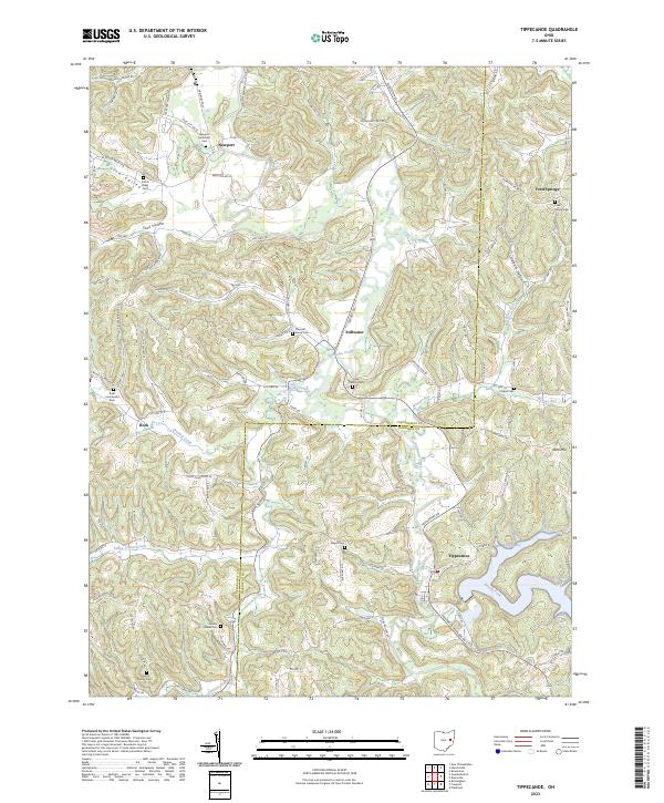
2023 Map of Tippecanoe
USGS Topo · Published 2023About this map
Stillwater Creek meanders through this portion of eastern Ohio, carving out a landscape defined by prominent drainage patterns like Dutch Valley and Toad Hollow. The settlement at Tippecanoe serves as a focal point near the southern reaches of the map, situated where the creek broadens into several inlets, including McConnell Bay and Log Cabin Bay. This 2023 edition reflects a region deeply marked by its rural heritage, with numerous burial sites such as Newport Methodist Cem, Mount Carmel Cem, and the Linden Family Cem scattered across the hills. The map illustrates the convergence of township and range lines across the Tuscarawas Co and Harrison Co border, revealing a network of secondary roads and local routes like Moravian Trail Rd SE that connect smaller communities like Newport and Stillwater.
Find a feature on this map
98 named features on this map. Tap any name to fly to it.
Don’t see what you’re looking for? This feature index may not catch every label — zoom into the map to look around manually.
Map Details
Editions of this 2023 Tippecanoe Map
This is the sole edition of this map. No revisions or reprints were ever made.
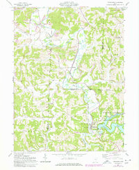
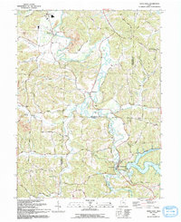
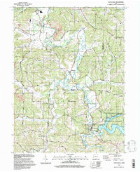
Historical Maps of Tippecanoe Through Time
4 maps found