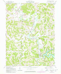
1961 Map of Tippecanoe
USGS Topo · Published 1978About this map
Tippecanoe and the lower reaches of Clendening Lake anchor the southern portion of this landscape, where the Baltimore and Ohio railroad follows the winding course of Stillwater Creek. The terrain is defined by the legacy of extraction, with numerous Strip Mines, a Mine Dump, and Kilns located near Newport. These industrial features sit alongside a dense network of rural landmarks, including Mount Carmel Church and cemeteries such as Chapel Cemetery and Mayes Cemetery, which provide critical points of interest for local historians and genealogists.
Find a feature on this map
49 named features on this map. Tap any name to fly to it.
Don’t see what you’re looking for? This feature index may not catch every label — zoom into the map to look around manually.
Map Details
Editions of this 1961 Tippecanoe Map
Other maps of this area

1902 · Scio
USGS Topo · 1:62,500

1903 · Flushing
USGS Topo · 1:62,500

1904 · Scio
USGS Topo · 1:62,500

1905 · Flushing
USGS Topo · 1:62,500

1909 · Antrim
USGS Topo · 1:48,000

1909 · Uhrichsville
USGS Topo · 1:62,500

1911 · Antrim
USGS Topo · 1:62,500

1911 · Uhrichsville
USGS Topo · 1:62,500

1951 · Canton
USGS Topo · 1:250,000

1953 · Canton
USGS Topo · 1:250,000