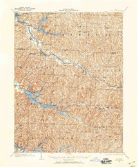
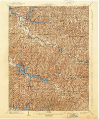
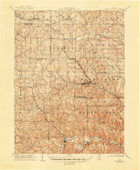
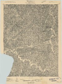
1902 Map of Scio
USGS Topo · Published 1959About this map
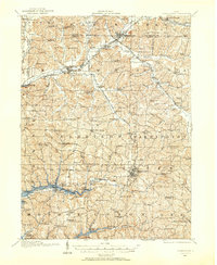
Scio and its surrounding townships in Carroll and Harrison counties appear at the turn of the century as a landscape defined by its deep valleys and burgeoning rail network. The Pittsburgh and Wheeling and Lake Erie railroads navigate the terrain alongside the Cincinnati Chicago and St. Louis, connecting vital trade hubs like Bowerston, Jewett, and Sherrodsville. A series of water management projects are central to this area, including the Dover Reservoir, Leesville Reservoir, and Clendening Reservoir. Small post offices and rural settlements like Lamartine P.O. Perryville and Tappan P.O. Franklin serve as focal points for local history, illustrating the distribution of residents before mid-century modernization. The map reveals the intricate drainage patterns of Stillwater and Conotton creeks that dictated the placement of pioneer roads and early homesteads.
Find a feature on this map
53 named features on this map. Tap any name to fly to it.
Don’t see what you’re looking for? This feature index may not catch every label — zoom into the map to look around manually.
Map Details
Editions of this 1902 Scio Map
This is the sole edition of this map. No revisions or reprints were ever made.
Other maps of this area

1901 · Cadiz
USGS Topo · 1:62,500

1903 · Cadiz
USGS Topo · 1:62,500

1903 · Flushing
USGS Topo · 1:62,500
1904 · Scio
USGS Topo · 1:62,500

1905 · St. Clairsville
USGS Topo · 1:62,500

1905 · Flushing
USGS Topo · 1:62,500
1905 · Salineville
USGS Topo · 1:62,500
1909 · Antrim
USGS Topo · 1:48,000

1909 · Uhrichsville
USGS Topo · 1:62,500
1910 · Carrollton
USGS Topo · 1:62,500