
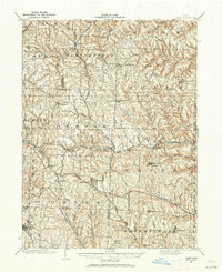
1901 Map of Cadiz
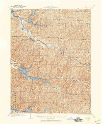
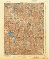
USGS Topo · Published 1954About this map
The rugged coal and rail country of eastern Ohio is defined here by its intricate network of steam-era transportation and hilltop settlements. During this era, the Pittsburgh Cincinnati Chicago and St Louis and the Wheeling and Lake Erie railroads carved through the deep valleys of Cross Creek and Piney Fork, connecting numerous station-side hamlets. These valleys stand in sharp contrast to the high ridges where older communities like Richmond and Germano were established. The map documents the specific locations of rural junctions and stations such as Cadiz Junc, Miller Sta, and Bloomfield Sta, which served as vital links for the agricultural and early industrial economy. Local genealogists will find value in the distinct placement of small crossroads like Circle Green, Shane, and Fife, providing a clear picture of the Harrison and Jefferson County borderlands before the mid-century expansion of modern highways.
Find a feature on this map
69 named features on this map. Tap any name to fly to it.
Don’t see what you’re looking for? This feature index may not catch every label — zoom into the map to look around manually.
Map Details
Editions of this 1901 Cadiz Map
2 editions found
Other maps of this area

1902 · Wheeling
USGS Topo · 1:62,500
1902 · Scio
USGS Topo · 1:62,500

1903 · Cadiz
USGS Topo · 1:62,500

1903 · Flushing
USGS Topo · 1:62,500

1904 · Wellsville
USGS Topo · 1:62,500

1904 · Steubenville
USGS Topo · 1:62,500
1904 · Scio
USGS Topo · 1:62,500

1905 · St. Clairsville
USGS Topo · 1:62,500

1905 · Flushing
USGS Topo · 1:62,500
1905 · Salineville
USGS Topo · 1:62,500