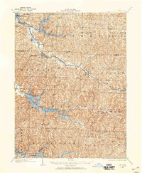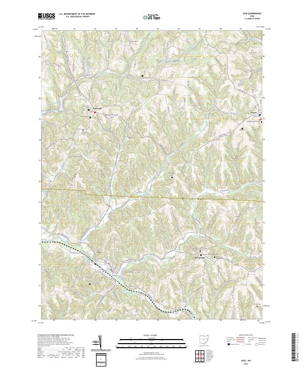
1904 Map of Scio
USGS Topo · Published 1944About this map
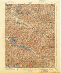
The Pittsburgh Cincinnati Chicago and St Louis RR dictates the development of the Conotton Creek valley, linking industrial and agricultural hubs like Bowerston and Scio. This 1902 survey, reprinted later with reservoir additions, captures the transition of the Harrison and Carroll County borderlands during a period of significant rail-dependent growth. While the northern half of the map is defined by the winding course of the Conotton Creek and its many forks, the southern portion features high-ridge settlements like Deersville and small rural stations such as Archer and Laceyville.
Find a feature on this map
49 named features on this map. Tap any name to fly to it.
Don’t see what you’re looking for? This feature index may not catch every label — zoom into the map to look around manually.
Map Details
Editions of this 1904 Scio Map
This is the sole edition of this map. No revisions or reprints were ever made.
Historical Maps of Cadiz Through Time
9 maps found