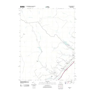
2010 Map of Tipton
USGS Topo · Published 2010About this map
The Little Juniata River carves through the southeast corner of this central Pennsylvania landscape, anchoring a corridor of rail and road infrastructure that connects Tyrone with smaller settlements like Grazierville, Charlottsville, and Gray. This 2010 survey illustrates the managed water resources vital to the region, including the Tipton Reservoir and its associated Tipton Dam, as well as Tyrone Reservoir Number One and Tyrone Reservoir Number Two tucked into the eastern hills.
Find a feature on this map
41 named features on this map. Tap any name to fly to it.
Don’t see what you’re looking for? This feature index may not catch every label — zoom into the map to look around manually.
Map Details
Editions of this 2010 Tipton Map
This is the sole edition of this map. No revisions or reprints were ever made.
Other maps of this area

1903 · Houtzdale
USGS Topo · 1:62,500

1905 · Houtzdale
USGS Topo · 1:62,500

1920 · Altoona
USGS Topo · 1:62,500

1922 · Philipsburg
USGS Topo · 1:62,500

1922 · Altoona
USGS Topo · 1:62,500

1923 · Tyrone
USGS Topo · 1:62,500

1929 · Tyrone
USGS Topo · 1:48,000

1933 · Tyrone
USGS Topo · 1:62,500

1939 · Philipsburg
USGS Topo · 1:62,500

1944 · Houtzdale
USGS Topo · 1:24,000