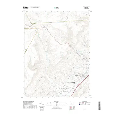
2019 Map of Tipton
USGS Topo · Published 2019About this map
Tipton and the neighboring settlements of Charlottsville and Grazierville anchor the southeastern corridor of this map, following the valley of the Little Juniata River. The landscape is defined by the sharp contrast between the valley floor's residential development and the steep, wooded rise of Brush Mountain and Lost Mountain. Numerous small family and community burial sites, such as the Fox Family Cemetery and the Jacker Burial Ground, are preserved in the higher elevations and hollows, including Fry Hollow and Mulligan Hollow.
Find a feature on this map
81 named features on this map. Tap any name to fly to it.
Don’t see what you’re looking for? This feature index may not catch every label — zoom into the map to look around manually.
Map Details
Editions of this 2019 Tipton Map
This is the sole edition of this map. No revisions or reprints were ever made.
Other maps of this area

1903 · Houtzdale
USGS Topo · 1:62,500

1905 · Houtzdale
USGS Topo · 1:62,500

1920 · Altoona
USGS Topo · 1:62,500

1922 · Philipsburg
USGS Topo · 1:62,500

1922 · Altoona
USGS Topo · 1:62,500

1923 · Tyrone
USGS Topo · 1:62,500

1929 · Tyrone
USGS Topo · 1:48,000

1933 · Tyrone
USGS Topo · 1:62,500

1939 · Philipsburg
USGS Topo · 1:62,500

1944 · Houtzdale
USGS Topo · 1:24,000