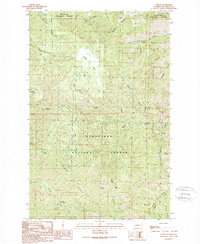
1989 Map of Tiptop
USGS Topo · Published 1989About this map
Camas Land sits as a high basin within the Wenatchee National Forest, defining the central topography of this 1989 provisional survey. The landscape is characterized by a complex network of drainages including Camas Creek, Sand Creek, and Poison Canyon, which carve through the elevations marked by Tronsen Ridge and Mission Ridge. At the summit of Tiptop, a radio tower site overlooks the surrounding wilderness, while the presence of a Quarry near the basin floor suggests localized resource extraction during this era.
Find a feature on this map
25 named features on this map. Tap any name to fly to it.
Don’t see what you’re looking for? This feature index may not catch every label — zoom into the map to look around manually.
Map Details
Editions of this 1989 Tiptop Map
This is the sole edition of this map. No revisions or reprints were ever made.
Other maps of this area

1897 · Mount Stuart
USGS Topo · 1:125,000

1901 · Chelan
USGS Topo · 1:125,000

1901 · Chiwaukum
USGS Topo · 1:125,000

1902 · Mount Stuart
USGS Topo · 1:125,000

1904 · Chiwaukum
USGS Topo · 1:125,000

1913 · Wenatchee
USGS Topo · 1:62,500

1915 · Wenatchee
USGS Topo · 1:62,500

1920 · Colockum Pass
USGS Topo · 1:125,000

1922 · Colockum Pass
USGS Topo · 1:125,000

1957 · Wenatchee
USGS Topo · 1:250,000