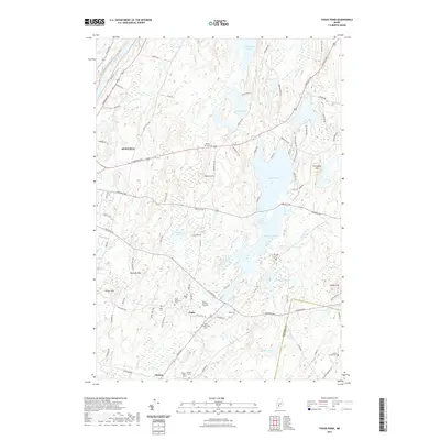
2021 Map of Togus Pond
USGS Topo · Published 2021About this map
Togus and the surrounding eastern suburbs of Augusta are characterized by a dense concentration of historical burial grounds and a complex system of interconnected waterways. The landscape is defined by its numerous ponds, including Togus Pond, Little Togus Pond, and Lower Togus Pond, which drain through Togus Stream toward the Kennebec River. Genealogists will find significant value in the documentation of several family-named and institutional cemeteries, such as the Togus National Cem and its East counterpart, along with the Searls Mills Cem, Trask Cem, and James Preble Cem. Significant topographic features like Bolton Hill and Porcupine Hill rise between the water bodies, while the area is bisected by major thoroughfares including North Belfast Avenue and Eastern Avenue, reflecting the transition from the city center to the rural-residential character of Chelsea.
Find a feature on this map
99 named features on this map. Tap any name to fly to it.
Don’t see what you’re looking for? This feature index may not catch every label — zoom into the map to look around manually.
Map Details
Editions of this 2021 Togus Pond Map
This is the sole edition of this map. No revisions or reprints were ever made.
Other maps of this area

1892 · Gardiner
USGS Topo · 1:62,500

1892 · Augusta
USGS Topo · 1:62,500

1893 · Vassalboro
USGS Topo · 1:62,500

1893 · Wiscasset
USGS Topo · 1:62,500

1898 · Vassalboro
USGS Topo · 1:62,500

1941 · Vassalboro
USGS Topo · 1:62,500

1941 · Augusta
USGS Topo · 1:62,500

1943 · Augusta
USGS Topo · 1:62,500

1943 · Gardiner
USGS Topo · 1:62,500

1943 · Vassalboro
USGS Topo · 1:62,500