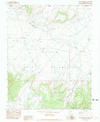
1982 Map of Toh Atin Mesa East
USGS Topo · Published 1983About this map
Navajo Indian Reservation lands dominate this corner of northeastern Arizona and southeastern Utah, centered on a high desert landscape of mesas and winding washes. The presence of the Red Mesa Trading Post near the northern border illustrates the enduring commercial and social hubs of the region during the late 1970s. Industrial activity is evident through the Rattlesnake Mine and various drill holes, while the complex infrastructure of a U/G Pipeline and Steel Towers Trans. Line cuts across the arid terrain.
Find a feature on this map
15 named features on this map. Tap any name to fly to it.
Don’t see what you’re looking for? This feature index may not catch every label — zoom into the map to look around manually.
Map Details
Editions of this 1982 Toh Atin Mesa East Map
This is the sole edition of this map. No revisions or reprints were ever made.
Other maps of this area

1886 · Abajo
USGS Topo · 1:250,000

1892 · Abajo
USGS Topo · 1:250,000

1892 · Canyon De Chelly
USGS Topo · 1:250,000

1893 · Abajo
USGS Topo · 1:250,000

1953 · Dinne Mesa NW
USGS Topo · 1:24,000

1953 · Pastora Peak SW
USGS Topo · 1:24,000

1953 · Pastora Peak NW
USGS Topo · 1:24,000

1953 · Dinne Mesa NE
USGS Topo · 1:24,000

1953 · Dinne Mesa SW
USGS Topo · 1:24,000

1953 · Dinne Mesa SE
USGS Topo · 1:24,000