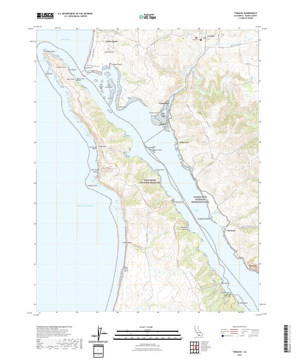
2022 Map of Tomales
USGS Topo · Published 2022About this map
Tomales Bay dominates this coastal survey, serving as a defining geological and cultural corridor between the Inverness Ridge and Bolinas Ridge. On the eastern shore, the historic village of Tomales sits slightly inland, supported by the Tomales Cem, while the waterfront is dotted with small coastal settlements like Marshall, Cypress Grove, and the site of Marconi. These locations reflect a long history of maritime activity and agricultural transport along the shoreline.
Find a feature on this map
77 named features on this map. Tap any name to fly to it.
Don’t see what you’re looking for? This feature index may not catch every label — zoom into the map to look around manually.
Map Details
Editions of this 2022 Tomales Map
This is the sole edition of this map. No revisions or reprints were ever made.
Other maps of this area

1916 · Point Reyes
USGS Topo · 1:48,000

1918 · Point Reyes
USGS Topo · 1:62,500

1935 · Sebastopol
USGS Topo · 1:48,000

1942 · Sebastopol
USGS Topo · 1:62,500

1942 · Bodega Head
USGS Topo · 1:24,000

1944 · Bodega Head
USGS Topo · 1:31,680

1947 · Santa Rosa
USGS Topo · 1:250,000

1949 · Santa Rosa
USGS Topo · 1:250,000

1953 · Drakes Bay
USGS Topo · 1:24,000
1954 · Two Rock
USGS Topo · 1:24,000