2022 Map of Tomball
USGS Topo · Published 2022About this map
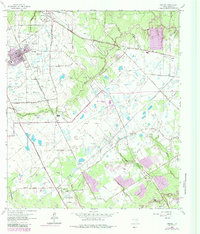
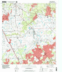
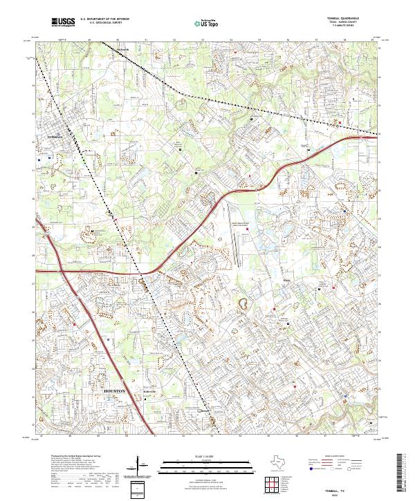
Cypress Creek and its many tributaries define the landscape of this Harris County region, where the historic communities of Tomball, Klein, and Hufsmith are increasingly connected by modern infrastructure like the Grand Pkwy. The map reveals a dense network of family and community heritage sites, including the McDougle Family Cem, the Trinity Lutheran Church Cem, and the Amos Cem near Kohrville. The area's transport and aviation history is anchored by the David Wayne Hooks Memorial Airport, while the intricate drainage system of gullies—such as Pilot Gully, Theiss Gully, and Faulkey Gully—illustrates the natural hydrology that shaped early settlement patterns. This detailed look at the Louetta and Tomball corridor captures the area as it balances suburban growth with its deep-rooted cemetery and church locations.
Find a feature on this map
29 named features on this map. Tap any name to fly to it.
Don’t see what you’re looking for? This feature index may not catch every label — zoom into the map to look around manually.
Map Details
Editions of this 2022 Tomball Map
This is the sole edition of this map. No revisions or reprints were ever made.