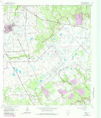
1962 Map of Tomball
USGS Topo · Published 1984About this map
Tomball and its surrounding Harris County settlements are captured during a period of transition as Houston’s suburban reach begins to extend northward. The landscape is defined by a dense network of petroleum extraction, including the Hufsmith Oil Field and the Southeast Tomball Oil Field, alongside the expanding Hooks Memorial Airport. This 1962 topography, updated with late 1970s revisions, shows a mix of rural heritage and industrial utility.
Find a feature on this map
41 named features on this map. Tap any name to fly to it.
Don’t see what you’re looking for? This feature index may not catch every label — zoom into the map to look around manually.
Map Details
Editions of this 1962 Tomball Map
4 editions found
Other maps of this area

1915 · Cypress
USGS Topo · 1:24,000

1916 · Rose Hill
USGS Topo · 1:24,000

1916 · Aldine
USGS Topo · 1:24,000

1916 · Louetta
USGS Topo · 1:24,000

1916 · Satsuma
USGS Topo · 1:24,000

1916 · Spring
USGS Topo · 1:24,000

1918 · Cypress
USGS Topo · 1:31,680

1919 · Aldine
USGS Topo · 1:31,680

1920 · Spring
USGS Topo · 1:31,680

1920 · Rose Hill
USGS Topo · 1:31,680