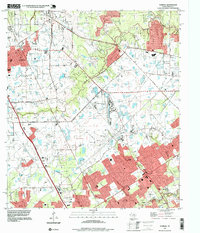
1995 Map of Tomball
USGS Topo · Published 1999About this map
Tomball and the surrounding Harris County prairie appear here during a period of significant suburban expansion in the mid-1990s. The landscape is defined by the transition from rural agricultural land and the Hufsimth Oil Field to residential developments, with the Tomball Corporate Boundary and Houston Corporate Boundary framing the growth. Numerous small family cemeteries like Pillot Cem and Stuckabree Cem remain as physical markers of the area's earlier settlement history. Waterways such as Willow Creek, Cypress Creek, and Spring Creek wind through the terrain, accompanied by smaller drainage features like Faulkey Gully and Theiss Gully. Significant transportation corridors, including Hufsmith Road and Stuebner - Airline Road, connect established communities like Klein and Kohrville with the aviation hub at Hooks Memorial Airport.
Find a feature on this map
40 named features on this map. Tap any name to fly to it.
Don’t see what you’re looking for? This feature index may not catch every label — zoom into the map to look around manually.
Map Details
Editions of this 1995 Tomball Map
This is the sole edition of this map. No revisions or reprints were ever made.
Other maps of this area

1915 · Cypress
USGS Topo · 1:24,000

1916 · Rose Hill
USGS Topo · 1:24,000

1916 · Aldine
USGS Topo · 1:24,000

1916 · Louetta
USGS Topo · 1:24,000

1916 · Satsuma
USGS Topo · 1:24,000

1916 · Spring
USGS Topo · 1:24,000

1918 · Cypress
USGS Topo · 1:31,680

1919 · Aldine
USGS Topo · 1:31,680

1920 · Spring
USGS Topo · 1:31,680

1920 · Rose Hill
USGS Topo · 1:31,680