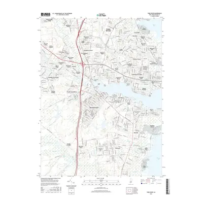
2016 Map of Toms River
USGS Topo · Published 2016About this map
The eponymous Toms River winds eastward through a dense network of suburban developments before opening into the Barnegat Bay in this 2016 survey. This coastal landscape is characterized by its established residential communities, from the planned streets of Pine Lake Park in the northwest to the waterfront neighborhoods of Island Heights and Gilford Park. The Garden State Parkway serves as a major north-south artery, bisecting the region and separating the more developed town centers from the marshy environments and pine-lined tributaries to the west.
Find a feature on this map
80 named features on this map. Tap any name to fly to it.
Don’t see what you’re looking for? This feature index may not catch every label — zoom into the map to look around manually.
Map Details
Editions of this 2016 Toms River Map
This is the sole edition of this map. No revisions or reprints were ever made.
Other maps of this area

1884 · Whitings
USGS Topo · 1:62,500

1888 · Barnegat
USGS Topo · 1:62,500

1888 · Asbury Park
USGS Topo · 1:62,500

1888 · Cassville
USGS Topo · 1:62,500

1888 · Whitings
USGS Topo · 1:62,500

1893 · Asbury Park
USGS Topo · 1:62,500

1893 · Barnegat
USGS Topo · 1:62,500

1894 · Cassville
USGS Topo · 1:62,500

1898 · Barnegat
USGS Topo · 1:62,500

1900 · Cassville
USGS Topo · 1:62,500