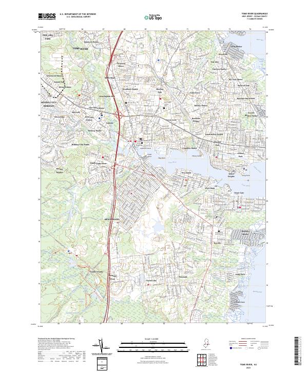
2023 Map of Toms River
USGS Topo · Published 2023About this map
Toms River serves as the focal point of this coastal landscape, where the river widens toward Barnegat Bay. The area shows a dense network of suburban developments such as Riverview Estates and Manitou Park, contrasted by the specialized retirement communities of Holiday City-Berkeley. Institutional and historical landmarks like the Ocean County Courthouse and Saint Joseph Catholic Cem anchor the older town center. South of the river, the planned grids of Beachwood and Pine Beach stretch toward the sprawling natural landscape of Double Trouble. This southern portion is defined by cedar swamps and tea-colored waterways including Jakes Branch and Cedar Creek, which feed into Swordens Pond. The presence of the Rogers Family Burial Ground near Bayville offers a specific point of interest for those tracing early local lineages amidst modern growth.
Find a feature on this map
85 named features on this map. Tap any name to fly to it.
Don’t see what you’re looking for? This feature index may not catch every label — zoom into the map to look around manually.
Map Details
Editions of this 2023 Toms River Map
This is the sole edition of this map. No revisions or reprints were ever made.
Other maps of this area

1884 · Whitings
USGS Topo · 1:62,500

1888 · Barnegat
USGS Topo · 1:62,500

1888 · Asbury Park
USGS Topo · 1:62,500

1888 · Cassville
USGS Topo · 1:62,500

1888 · Whitings
USGS Topo · 1:62,500

1893 · Asbury Park
USGS Topo · 1:62,500

1893 · Barnegat
USGS Topo · 1:62,500

1894 · Cassville
USGS Topo · 1:62,500

1898 · Barnegat
USGS Topo · 1:62,500

1900 · Cassville
USGS Topo · 1:62,500