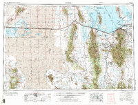
1953 Map of Tooele
USGS Topo · Published 1973About this map
The Tooele Army Depot and Dugway Proving Ground dominate the high-desert landscape of western Utah in this mid-century survey. While the western expanse is defined by the Great Salt Lake Desert and the Bonneville Salt Flats Race Track, the eastern section shows the transition into the Oquirrh Mountains and the massive Bingham Canyon Mine. Transportation infrastructure reflects the region's role as a continental corridor, with the Western Pacific and Union Pacific railroads traversing the valleys and salt flats.
Find a feature on this map
111 named features on this map. Tap any name to fly to it.
Don’t see what you’re looking for? This feature index may not catch every label — zoom into the map to look around manually.
Map Details
Editions of this 1953 Tooele Map
3 editions found

Other maps of this area

1885 · Salt Lake
USGS Topo · 1:250,000

1885 · Manti
USGS Topo · 1:250,000

1885 · Sevier Desert
USGS Topo · 1:250,000

1885 · Tooele Valley
USGS Topo · 1:250,000

1895 · Manti
USGS Topo · 1:250,000

1908 · Fish Springs
USGS Topo · 1:250,000

1910 · Fish Springs
USGS Topo · 1:250,000

1915 · Fairfield
USGS Topo · 1:62,500

1917 · Fairfield
USGS Topo · 1:62,500

1918 · Stockton
USGS Topo · 1:62,500