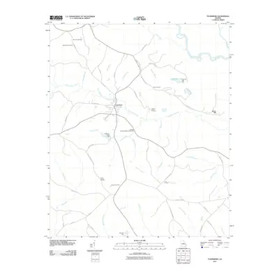
2011 Map of Toomsboro
USGS Topo · Published 2011About this map
Toomsboro serves as the central hub of this Wilkinson County landscape, situated at the junction of the C T Lord Hwy and S Railroad St. The town's layout reflects a classic Georgia rail-corridor development, with local thoroughfares like Sheppard St and Frank Mills Rd radiating toward the surrounding rural reaches. The area is notable for its high density of family and community burial grounds, including the David Clay Cemetery, Collins Cemetery, and Ebenezer Cemetery, providing a wealth of geographic data for genealogists tracing ancestral roots in the region.
Find a feature on this map
58 named features on this map. Tap any name to fly to it.
Don’t see what you’re looking for? This feature index may not catch every label — zoom into the map to look around manually.
Map Details
Editions of this 2011 Toomsboro Map
This is the sole edition of this map. No revisions or reprints were ever made.
Other maps of this area

1916 · Irwinton
USGS Topo · 1:62,500

1920 · Irwinton
USGS Topo · 1:62,500

1957 · Macon
USGS Topo · 1:250,000

1958 · Macon
USGS Topo · 1:250,000

1962 · Oconee
USGS Topo · 1:24,000

1962 · Tabernacle
USGS Topo · 1:24,000

1964 · Macon
USGS Topo · 1:250,000
1973 · Napier Pond
USGS Topo · 1:24,000
1973 · Irwinton
USGS Topo · 1:24,000
1973 · Toomsboro
USGS Topo · 1:24,000