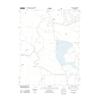
2012 Map of Topaz Lake
USGS Topo · Published 2012About this map
Topaz Lake straddles the high-altitude border region between Nevada and California, serving as a focal point for this 2012 survey. The landscape is defined by the sharp transition from the aquatic basin to the surrounding peaks, including Wild Oat Mountain to the east and the high ridges of Leviathan Peak and Monitor Pass to the southwest. Settlement patterns are concentrated at Holbrook Junction and the residential layout of Topaz Ranch, where street names like Andesite Rd and Zeolite Cir reflect the geological character of the Great Basin. Agricultural infrastructure remains prominent in the south, where the West Walker River feeds a network of water management features including the Alkali Ditch, Swager Ditch, and Wiley Ditch. This era shows a mix of recreational geography near the shoreline and established ranching operations like Fairfield Ranch, alongside natural springs such as Virgil Connell Spring.
Find a feature on this map
50 named features on this map. Tap any name to fly to it.
Don’t see what you’re looking for? This feature index may not catch every label — zoom into the map to look around manually.
Map Details
Editions of this 2012 Topaz Lake Map
This is the sole edition of this map. No revisions or reprints were ever made.
Other maps of this area

1889 · Markleeville
USGS Topo · 1:125,000

1891 · Markleeville
USGS Topo · 1:125,000

1891 · Wellington
USGS Topo · 1:125,000

1893 · Markleeville
USGS Topo · 1:125,000

1893 · Wellington
USGS Topo · 1:125,000

1948 · Walker Lake
USGS Topo · 1:250,000

1956 · Desert Creek Peak
USGS Topo · 1:62,500

1956 · Topaz Lake
USGS Topo · 1:62,500

1957 · Walker Lake
USGS Topo · 1:250,000

1957 · Wellington
USGS Topo · 1:62,500