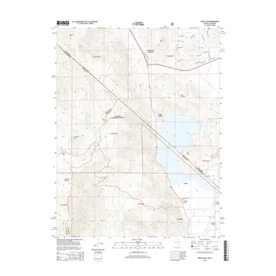
2014 Map of Topaz Lake
USGS Topo · Published 2014About this map
Topaz Lake straddles the rugged border between Nevada and California, serving as a focal point for this high-desert landscape in the early 21st century. The map details a complex network of water management features, including the Topaz Canal, Wiley Ditch, and Alkali Ditch, which redirect flow from the West Walker River to support the surrounding Antelope Valley. Settlements like Coleville and Topaz are situated along the valley floor, while the terrain rises sharply to the west into the Toiyabe National Forest. High-altitude landmarks such as Leviathan Peak and Monitor Pass define the western reaches, contrasted by the more developed residential grid of Holbrook Junction to the north. This survey captures the vital relationship between the region's steep topography and the irrigation systems that sustain life in the basin.
Find a feature on this map
53 named features on this map. Tap any name to fly to it.
Don’t see what you’re looking for? This feature index may not catch every label — zoom into the map to look around manually.
Map Details
Editions of this 2014 Topaz Lake Map
This is the sole edition of this map. No revisions or reprints were ever made.
Other maps of this area

1889 · Markleeville
USGS Topo · 1:125,000

1891 · Markleeville
USGS Topo · 1:125,000

1891 · Wellington
USGS Topo · 1:125,000

1893 · Markleeville
USGS Topo · 1:125,000

1893 · Wellington
USGS Topo · 1:125,000

1948 · Walker Lake
USGS Topo · 1:250,000

1956 · Desert Creek Peak
USGS Topo · 1:62,500

1956 · Topaz Lake
USGS Topo · 1:62,500

1957 · Walker Lake
USGS Topo · 1:250,000

1957 · Wellington
USGS Topo · 1:62,500