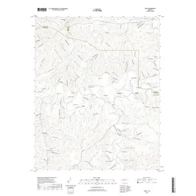
2019 Map of Topsy
USGS Topo · Published 2019About this map
Buffalo River meanders through this portion of the Tennessee Highland Rim, carving deep bends like Bachelor Bend and Johnson Bend. The settlement patterns here are defined by the tight topography of the hollows, with family-named cemeteries such as Beatty Cem, Skelton Cem, and Hollabaugh Cem serving as vital markers for local genealogical research. In the southern reach, Moccasin sits near the confluence of Moccasin Cr and E Prong Moccasin Cr, while the village of Topsy remains a central landmark along the Topsy-Hohenwald Rd. The map also captures several distinctive natural and built features, including the The Court House landmark near Rainbow Lake, and numerous springs like Cave Spring and Spout Spring that suggest the karst-influenced hydrology of Wayne and Lewis counties.
Find a feature on this map
144 named features on this map. Tap any name to fly to it.
Don’t see what you’re looking for? This feature index may not catch every label — zoom into the map to look around manually.
Map Details
Editions of this 2019 Topsy Map
This is the sole edition of this map. No revisions or reprints were ever made.
Other maps of this area

1905 · Waynesboro
USGS Topo · 1:125,000

1936 · Riverside
USGS Topo · 1:24,000

1936 · Graves Spring
USGS Topo · 1:24,000

1936 · Linden
USGS Topo · 1:24,000

1936 · Leatherwood
USGS Topo · 1:24,000

1936 · Negro Hollow
USGS Topo · 1:24,000

1936 · Kimmins
USGS Topo · 1:24,000

1936 · Waynesboro
USGS Topo · 1:24,000

1936 · Topsy
USGS Topo · 1:24,000

1936 · Ovilla
USGS Topo · 1:24,000