
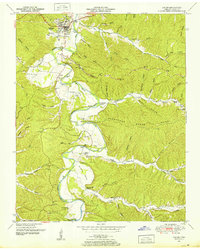
1936 Map of Topsy
USGS Topo · Published 1936About this map
The Buffalo River snakes through the central hills of Wayne County in this 1930s survey, defining a landscape where travel relied heavily on river crossings like Carey Ford and Meredith Ford. The tiny settlement of Topsy serves as a central point for a rural community characterized by small family-named hollows and isolated schoolhouses, including the Topsy Sch and Morrow Valley Sch. The presence of the Tennessee Electric Power Company transmission line cutting across the northern reaches indicates the early infrastructure shifts of the Tennessee Valley Authority era.
Find a feature on this map
94 named features on this map. Tap any name to fly to it.
Don’t see what you’re looking for? This feature index may not catch every label — zoom into the map to look around manually.
Map Details
Editions of this 1936 Topsy Map
This is the sole edition of this map. No revisions or reprints were ever made.
Other maps of this area

1905 · Waynesboro
USGS Topo · 1:125,000

1936 · Riverside
USGS Topo · 1:24,000

1936 · Graves Spring
USGS Topo · 1:24,000

1936 · Linden
USGS Topo · 1:24,000

1936 · Leatherwood
USGS Topo · 1:24,000

1936 · Negro Hollow
USGS Topo · 1:24,000

1936 · Kimmins
USGS Topo · 1:24,000

1936 · Waynesboro
USGS Topo · 1:24,000

1936 · Ovilla
USGS Topo · 1:24,000
1950 · Linden
USGS Topo · 1:24,000