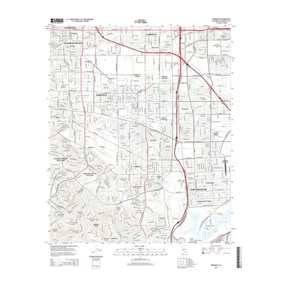
2015 Map of Torrance
USGS Topo · Published 2015About this map
Zamperini Field serves as a central aviation landmark in this detailed urban and coastal survey, illustrating the dense suburban development of the South Bay and Harbor areas. The landscape is a complex grid of residential communities like Torrance and West Carson, interspersed with significant industrial and educational sites such as California State University-Dominguez Hills. Waterways like the Dominiguez Channel and Harbor Lake cut through the coastal plain, while the terrain transitions sharply in the south toward the ridges of the Palos Verdes Peninsula. Numerous memorial sites, including Pacific Crest Cemetery and Green Hills Memorial Park, suggest a long-established community history. Transport infrastructure is prominent, from the heavy rail corridors meeting at Watson Junction to the Vincent Thomas Bridge spanning the southern waterways, providing a comprehensive view of the region's mid-2010s urban geography.
Find a feature on this map
70 named features on this map. Tap any name to fly to it.
Don’t see what you’re looking for? This feature index may not catch every label — zoom into the map to look around manually.
Map Details
Editions of this 2015 Torrance Map
This is the sole edition of this map. No revisions or reprints were ever made.
Other maps of this area

1896 · Redondo
USGS Topo · 1:62,500

1896 · Las Bolsas
USGS Topo · 1:62,500

1896 · San Pedro
USGS Topo · 1:62,500

1896 · Downey
USGS Topo · 1:62,500

1899 · Downey
USGS Topo · 1:62,500

1901 · Southern California Sheet No. 1
USGS Topo · 1:250,000

1902 · Downey
USGS Topo · 1:62,500

1904 · Southern California Sheet No. 1
USGS Topo · 1:250,000

1923 · Wilmington
USGS Topo · 1:24,000

1924 · Torrance
USGS Topo · 1:24,000