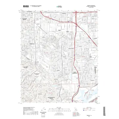
2021 Map of Torrance
USGS Topo · Published 2021About this map
Torrance and its neighboring South Bay communities are documented here during a period of dense suburban and industrial maturity. The landscape is defined by the sharp transition from the elevated Palos Verdes Hills in the southwest, where Rolling Hills and Rancho Palos Verdes overlook the coast, to the intensive infrastructure of the harbor district. To the southeast, the complex waterways of the Cerritos Channel and East Basin Channel wrap around Mormon Island and Smith Island, marking the industrial heart of Wilmington. Key regional landmarks include Zamperini Field and the California State University Dominguez Hills campus. The mapping reveals a tightly integrated network of established neighborhoods like Walteria, Lomita, and Harbor City, supported by essential facilities such as the Los Angeles County Torrance Courthouse and Green Hills Memorial Park.
Find a feature on this map
63 named features on this map. Tap any name to fly to it.
Don’t see what you’re looking for? This feature index may not catch every label — zoom into the map to look around manually.
Map Details
Editions of this 2021 Torrance Map
This is the sole edition of this map. No revisions or reprints were ever made.
Other maps of this area

1896 · Redondo
USGS Topo · 1:62,500

1896 · Las Bolsas
USGS Topo · 1:62,500

1896 · San Pedro
USGS Topo · 1:62,500

1896 · Downey
USGS Topo · 1:62,500

1899 · Downey
USGS Topo · 1:62,500

1901 · Southern California Sheet No. 1
USGS Topo · 1:250,000

1902 · Downey
USGS Topo · 1:62,500

1904 · Southern California Sheet No. 1
USGS Topo · 1:250,000

1923 · Wilmington
USGS Topo · 1:24,000

1924 · Torrance
USGS Topo · 1:24,000