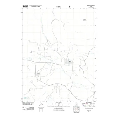
2011 Map of Torrey
USGS Topo · Published 2011About this map
The high-country settlement of Torrey serves as a central hub in this Southern Utah landscape, where the Fremont River and its accompanying Torrey Canal provide vital water resources for the high-elevation valley. Just west, the village of Teasdale sits near the base of the mountains, connected by a network of local roads such as Rustle St and 1st St E. The drainage patterns are clearly defined by numerous waterways, including Sand Creek, Cottonwood Creek, and Sulphur Creek, which carve through the terrain toward the South Fork Spring Canyon.
Find a feature on this map
35 named features on this map. Tap any name to fly to it.
Don’t see what you’re looking for? This feature index may not catch every label — zoom into the map to look around manually.
Map Details
Editions of this 2011 Torrey Map
This is the sole edition of this map. No revisions or reprints were ever made.
Other maps of this area

1885 · Fish Lake
USGS Topo · 1:250,000

1896 · Fish Lake
USGS Topo · 1:250,000

1952 · Notom 2 NW
USGS Topo · 1:24,000

1952 · Loa 1 SE
USGS Topo · 1:24,000

1952 · Notom 3 NW
USGS Topo · 1:24,000

1952 · Notom 2 SE
USGS Topo · 1:24,000

1952 · Notom 2 SW
USGS Topo · 1:24,000

1952 · Notom 2 NE
USGS Topo · 1:24,000

1952 · Notom 3 NE
USGS Topo · 1:24,000

1952 · Grover
USGS Topo · 1:62,500