
1952 Map of Notom 2 NE
USGS Topo · Published 1954About this map
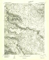
Fishlake National Forest boundaries define the southwestern portion of this 1952 topographic study, where the high desert plateau meets deep drainage systems. The landscape is characterized by its dramatic verticality, captured here during a transition in mapping technology from multiplex methods and 1951 aerial photography. Waterways such as South Creek and Polk Creek have carved significant features into the Middle Desert, creating prominent landmarks like Paradise Flats and Little Sand Flat. The map highlights the boundary line between Emery and Wayne Counties, showing how political divisions follow the high ridges above Hartnet Draw and Paradise Draw. This era of mapping emphasizes the natural landforms before modern infrastructure, focusing on the intricate network of draws and creeks that define the regional hydrology.
Find a feature on this map
10 named features on this map. Tap any name to fly to it.
Don’t see what you’re looking for? This feature index may not catch every label — zoom into the map to look around manually.
Map Details
Editions of this 1952 Notom 2 NE Map
This is the sole edition of this map. No revisions or reprints were ever made.
Other maps of this area

1885 · Fish Lake
USGS Topo · 1:250,000

1896 · Fish Lake
USGS Topo · 1:250,000

1952 · Notom 2 NW
USGS Topo · 1:24,000

1952 · Notom 2 SE
USGS Topo · 1:24,000

1952 · Notom 2 SW
USGS Topo · 1:24,000

1952 · Notom 1 SW
USGS Topo · 1:24,000

1952 · Torrey
USGS Topo · 1:62,500

1954 · Fruita
USGS Topo · 1:62,500
1954 · Notom 1 NW
USGS Topo · 1:24,000

1956 · Salina
USGS Topo · 1:250,000