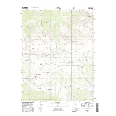
2017 Map of Torrey
USGS Topo · Published 2017About this map
Torrey and Teasdale anchor this high-desert landscape where irrigation and rugged geography meet. The Fremont River flows eastward, diverted by the Torrey Canal to support agriculture near Poverty Flat. The settlement pattern follows the river valley and the base of the Teasdale Bench, while the surrounding terrain is defined by dramatic geological formations like Velvet Ridge, The Ant Hill, and Cooks Mesa.
Find a feature on this map
98 named features on this map. Tap any name to fly to it.
Don’t see what you’re looking for? This feature index may not catch every label — zoom into the map to look around manually.
Map Details
Editions of this 2017 Torrey Map
This is the sole edition of this map. No revisions or reprints were ever made.
Other maps of this area

1885 · Fish Lake
USGS Topo · 1:250,000

1896 · Fish Lake
USGS Topo · 1:250,000

1952 · Notom 2 NW
USGS Topo · 1:24,000

1952 · Loa 1 SE
USGS Topo · 1:24,000

1952 · Notom 3 NW
USGS Topo · 1:24,000

1952 · Notom 2 SE
USGS Topo · 1:24,000

1952 · Notom 2 SW
USGS Topo · 1:24,000

1952 · Notom 2 NE
USGS Topo · 1:24,000

1952 · Notom 3 NE
USGS Topo · 1:24,000

1952 · Grover
USGS Topo · 1:62,500