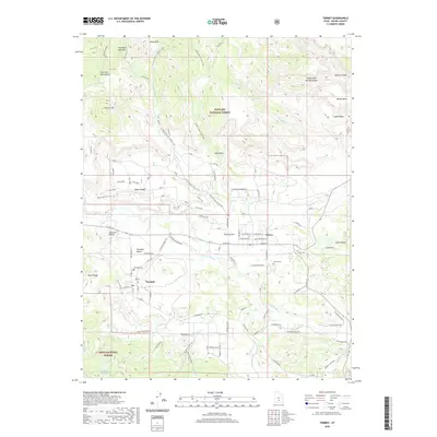
2020 Map of Torrey
USGS Topo · Published 2020About this map
The Fremont River valley serves as the central artery for this high-desert landscape, where the small communities of Torrey and Teasdale are situated amidst a network of intricate water systems like the Torrey Canal. To the north, the massive uplift of Thousand Lake Mtn and the depths of Hells Hole dominate the horizon within the Fishlake National Forest, while the southern reaches are marked by the Dixie National Forest and features like Flatiron Lakes.
Find a feature on this map
84 named features on this map. Tap any name to fly to it.
Don’t see what you’re looking for? This feature index may not catch every label — zoom into the map to look around manually.
Map Details
Editions of this 2020 Torrey Map
This is the sole edition of this map. No revisions or reprints were ever made.
Other maps of this area

1885 · Fish Lake
USGS Topo · 1:250,000

1896 · Fish Lake
USGS Topo · 1:250,000

1952 · Notom 2 NW
USGS Topo · 1:24,000

1952 · Loa 1 SE
USGS Topo · 1:24,000

1952 · Notom 3 NW
USGS Topo · 1:24,000

1952 · Notom 2 SE
USGS Topo · 1:24,000

1952 · Notom 2 SW
USGS Topo · 1:24,000

1952 · Notom 2 NE
USGS Topo · 1:24,000

1952 · Notom 3 NE
USGS Topo · 1:24,000

1952 · Grover
USGS Topo · 1:62,500