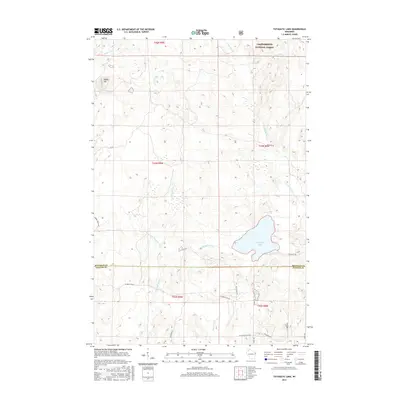
2015 Map of Totagatic Lake
USGS Topo · Published 2015About this map
The waters of Totagatic Lake and the Totagatic River dominate this portion of the Wisconsin Northwoods, where the landscape transitions between the southern reaches of Chequamegon National Forest and private timberlands. The survey reveals a complex hydrological network defined by the Ounce River and Hills Mill Cr, alongside several significant wetlands and smaller basins like Sabin Lake. Topographical variation is most pronounced at Smoky Hill, overlooking the Otter Cr drainage. This mid-2010s data captures the region's managed wilderness character, marked by a sparse grid of forest service routes and local tracks such as W Seeley Fire Ln and Tagalder Trl. The boundary between Bayfield and Sawyer Counties bisects the area just south of the main lake, providing a clear reference for local land records and recreational navigation.
Find a feature on this map
29 named features on this map. Tap any name to fly to it.
Don’t see what you’re looking for? This feature index may not catch every label — zoom into the map to look around manually.
Map Details
Editions of this 2015 Totagatic Lake Map
This is the sole edition of this map. No revisions or reprints were ever made.
Other maps of this area

1944 · Drummond
USGS Topo · 1:48,000

1944 · Hayward
USGS Topo · 1:48,000

1945 · Highland
USGS Topo · 1:48,000

1947 · Drummond
USGS Topo · 1:48,000

1947 · Chittamo
USGS Topo · 1:48,000

1949 · Chittamo
USGS Topo · 1:48,000

1949 · Highland
USGS Topo · 1:48,000

1953 · Ashland
USGS Topo · 1:250,000

1958 · Ashland
USGS Topo · 1:250,000
1961 · Ellison Lake
USGS Topo · 1:62,500