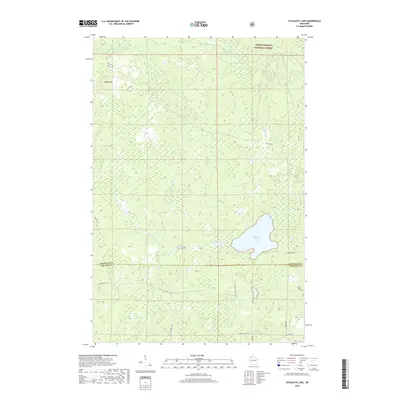
2018 Map of Totagatic Lake
USGS Topo · Published 2018About this map
Chequamegon National Forest encompasses much of this Wisconsin landscape, where the northern wetlands and thick woodlands are defined by a complex network of waterways. The Totagatic River and its W Fork Totagatic River course through the terrain, feeding into the prominent Totagatic Lake. This 2018 survey illustrates the remote character of the border between Bayfield and Sawyer Counties, revealing a landscape primarily accessed by fire lanes and forest roads rather than dense urban settlements.
Find a feature on this map
22 named features on this map. Tap any name to fly to it.
Don’t see what you’re looking for? This feature index may not catch every label — zoom into the map to look around manually.
Map Details
Editions of this 2018 Totagatic Lake Map
This is the sole edition of this map. No revisions or reprints were ever made.
Other maps of this area

1944 · Drummond
USGS Topo · 1:48,000

1944 · Hayward
USGS Topo · 1:48,000

1945 · Highland
USGS Topo · 1:48,000

1947 · Drummond
USGS Topo · 1:48,000

1947 · Chittamo
USGS Topo · 1:48,000

1949 · Chittamo
USGS Topo · 1:48,000

1949 · Highland
USGS Topo · 1:48,000

1953 · Ashland
USGS Topo · 1:250,000

1958 · Ashland
USGS Topo · 1:250,000
1961 · Ellison Lake
USGS Topo · 1:62,500