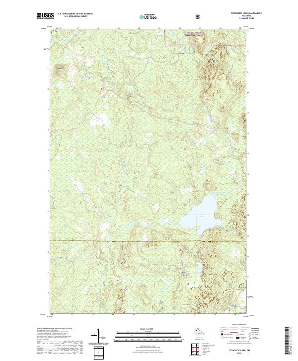
2022 Map of Totagatic Lake
USGS Topo · Published 2022About this map
Chequamegon National Forest defines the northern reaches of this landscape, where the Ounce River and Otter Cr cut through the timberland. The terrain is characterized by its complex hydrology, with the Totagatic River and its W Fork Totagatic River winding south toward Totagatic Lake. This 2022 survey captures the modern interface of protected wilderness and local access, showing a network of fire lanes and forest roads like W Seeley Fire Ln and Hills Mills Rd that provide entry into the backcountry.
Find a feature on this map
29 named features on this map. Tap any name to fly to it.
Don’t see what you’re looking for? This feature index may not catch every label — zoom into the map to look around manually.
Map Details
Editions of this 2022 Totagatic Lake Map
This is the sole edition of this map. No revisions or reprints were ever made.
Other maps of this area

1944 · Drummond
USGS Topo · 1:48,000

1944 · Hayward
USGS Topo · 1:48,000

1945 · Highland
USGS Topo · 1:48,000

1947 · Drummond
USGS Topo · 1:48,000

1947 · Chittamo
USGS Topo · 1:48,000

1949 · Chittamo
USGS Topo · 1:48,000

1949 · Highland
USGS Topo · 1:48,000

1953 · Ashland
USGS Topo · 1:250,000

1958 · Ashland
USGS Topo · 1:250,000
1961 · Ellison Lake
USGS Topo · 1:62,500