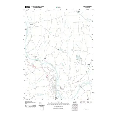
2010 Map of Towanda
USGS Topo · Published 2010About this map
The Susquehanna River defines the central axis of this Bradford County landscape, winding past the settlements of Towanda, North Towanda, and East Towanda. The river's path is marked by features like Bald Eagle Island and is joined by several significant tributaries, including Sugar Creek and Horn Brook. This map captures a developed valley floor where residential and commercial centers give way to higher terrain dotted with smaller hamlets such as Ghent and Hornbrook.
Find a feature on this map
96 named features on this map. Tap any name to fly to it.
Don’t see what you’re looking for? This feature index may not catch every label — zoom into the map to look around manually.
Map Details
Editions of this 2010 Towanda Map
This is the sole edition of this map. No revisions or reprints were ever made.
Other maps of this area

1923 · Towanda
USGS Topo · 1:62,500

1926 · Towanda
USGS Topo · 1:62,500

1939 · Sayre
USGS Topo · 1:62,500

1942 · Sayre
USGS Topo · 1:62,500

1943 · Towanda
USGS Topo · 1:62,500

1943 · Monroeton
USGS Topo · 1:62,500

1943 · Powell
USGS Topo · 1:62,500

1945 · Powell
USGS Topo · 1:62,500

1948 · Sayre
USGS Topo · 1:62,500

1954 · Williamsport
USGS Topo · 1:250,000