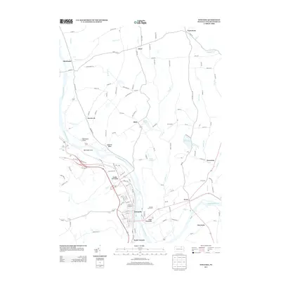
2013 Map of Towanda
USGS Topo · Published 2013About this map
The Susquehanna River dominates this landscape, carving a wide valley through Bradford County that has long dictated the placement of settlements and transport. Along its banks, the established borough of Towanda serves as a focal point, flanked by residential and industrial pockets in North Towanda, South Towanda, and East Towanda. The river's influence is clear at Bald Eagle Island and in the surrounding tributaries like Wysox Cr and Sugar Cr. Away from the river, the terrain rises into upland communities such as Ghent and Black, where the land use transitions to more dispersed rural patterns. Notable recreation and infrastructure are found throughout the area, from the Towanda Golf Course to the small Veit Airport, while local geography is marked by distinctive water bodies like Lake Wesauking and Shores Pond.
Find a feature on this map
122 named features on this map. Tap any name to fly to it.
Don’t see what you’re looking for? This feature index may not catch every label — zoom into the map to look around manually.
Map Details
Editions of this 2013 Towanda Map
This is the sole edition of this map. No revisions or reprints were ever made.
Other maps of this area

1923 · Towanda
USGS Topo · 1:62,500

1926 · Towanda
USGS Topo · 1:62,500

1939 · Sayre
USGS Topo · 1:62,500

1942 · Sayre
USGS Topo · 1:62,500

1943 · Towanda
USGS Topo · 1:62,500

1943 · Monroeton
USGS Topo · 1:62,500

1943 · Powell
USGS Topo · 1:62,500

1945 · Powell
USGS Topo · 1:62,500

1948 · Sayre
USGS Topo · 1:62,500

1954 · Williamsport
USGS Topo · 1:250,000