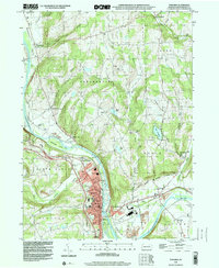
1998 Map of Towanda
USGS Topo · Published 1999About this map
Towanda serves as the focal point of this late 1990s survey, positioned where Sugar Creek meets the Susquehanna River. The borough's grid is dense with civic landmarks, including the St Agnes Sch and Oak Hill Cemetery, while its industrial and utility character is defined by the Sewage Disposal facility and the river's Gaging Sta. Across the water, East Towanda transitions into a more recreational landscape, featuring a Golf Course, Fairgrounds, and a Drive-in Theater.
Find a feature on this map
65 named features on this map. Tap any name to fly to it.
Don’t see what you’re looking for? This feature index may not catch every label — zoom into the map to look around manually.
Map Details
Editions of this 1998 Towanda Map
This is the sole edition of this map. No revisions or reprints were ever made.
Other maps of this area

1923 · Towanda
USGS Topo · 1:62,500

1926 · Towanda
USGS Topo · 1:62,500

1939 · Sayre
USGS Topo · 1:62,500

1942 · Sayre
USGS Topo · 1:62,500

1943 · Towanda
USGS Topo · 1:62,500

1943 · Monroeton
USGS Topo · 1:62,500

1943 · Powell
USGS Topo · 1:62,500

1945 · Powell
USGS Topo · 1:62,500

1948 · Sayre
USGS Topo · 1:62,500

1954 · Williamsport
USGS Topo · 1:250,000