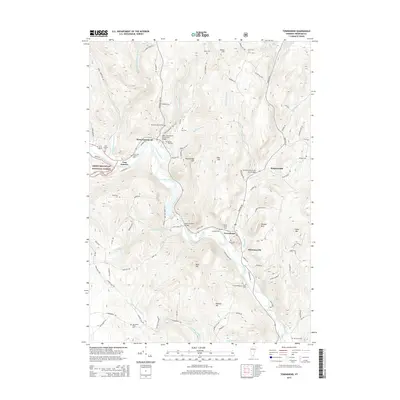
2015 Map of Townshend
USGS Topo · Published 2015About this map
The West River defines the corridor of settlement and infrastructure through this part of Windham County, where the historic Scott Covered Bridge and two notable stone arch bridges—the West Townshend Stone Arch Bridge and Simpsonville Stone Arch Bridge—cross the valley's waterways. The village of Townshend sits at the heart of the area, bordered by Harmonyville to the south and the Townshend Reservoir to the northwest. This landscape is a dense record of early Vermont families, evidenced by numerous small burial sites like the Sanderson Burial Plot, Taft Cem, and the Holland-Brigham-Bixby Cem. High peaks such as Bald Mtn, Peaked Mtn, and Crane Mtn overlook the winding routes of Wardsboro Brook and Negro Brook, while the Us Corps Eng Park near the reservoir indicates mid-century federal water management efforts integrated into the older valley towns.
Find a feature on this map
103 named features on this map. Tap any name to fly to it.
Don’t see what you’re looking for? This feature index may not catch every label — zoom into the map to look around manually.
Map Details
Editions of this 2015 Townshend Map
This is the sole edition of this map. No revisions or reprints were ever made.
Other maps of this area

1889 · Wilmington
USGS Topo · 1:62,500

1891 · Wilmington
USGS Topo · 1:62,500

1891 · Brattleboro
USGS Topo · 1:62,500

1893 · Brattleboro
USGS Topo · 1:62,500

1894 · Londonderry
USGS Topo · 1:62,500

1899 · Londonderry
USGS Topo · 1:62,500

1899 · Wilmington
USGS Topo · 1:62,500

1930 · Saxtons River
USGS Topo · 1:48,000

1932 · Brattleboro
USGS Topo · 1:48,000

1933 · Saxtons River
USGS Topo · 1:62,500