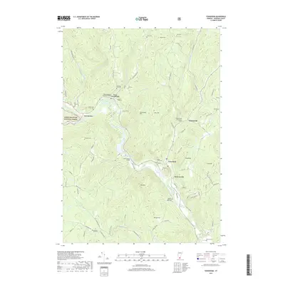
2018 Map of Townshend
USGS Topo · Published 2018About this map
The West River carves a deep valley through this portion of Windham County, serving as the historical and geographic spine for the villages of Townshend, Harmonyville, and West Townshend. The river's influence on local infrastructure is evident in the preservation of classic New England crossings, including the Scott Covered Bridge and the West Townshend Stone Arch Bridge. Further east, Simpsonville is marked by its own Stone Arch Bridge over Mill Brook.
Find a feature on this map
92 named features on this map. Tap any name to fly to it.
Don’t see what you’re looking for? This feature index may not catch every label — zoom into the map to look around manually.
Map Details
Editions of this 2018 Townshend Map
This is the sole edition of this map. No revisions or reprints were ever made.
Other maps of this area

1889 · Wilmington
USGS Topo · 1:62,500

1891 · Wilmington
USGS Topo · 1:62,500

1891 · Brattleboro
USGS Topo · 1:62,500

1893 · Brattleboro
USGS Topo · 1:62,500

1894 · Londonderry
USGS Topo · 1:62,500

1899 · Londonderry
USGS Topo · 1:62,500

1899 · Wilmington
USGS Topo · 1:62,500

1930 · Saxtons River
USGS Topo · 1:48,000

1932 · Brattleboro
USGS Topo · 1:48,000

1933 · Saxtons River
USGS Topo · 1:62,500