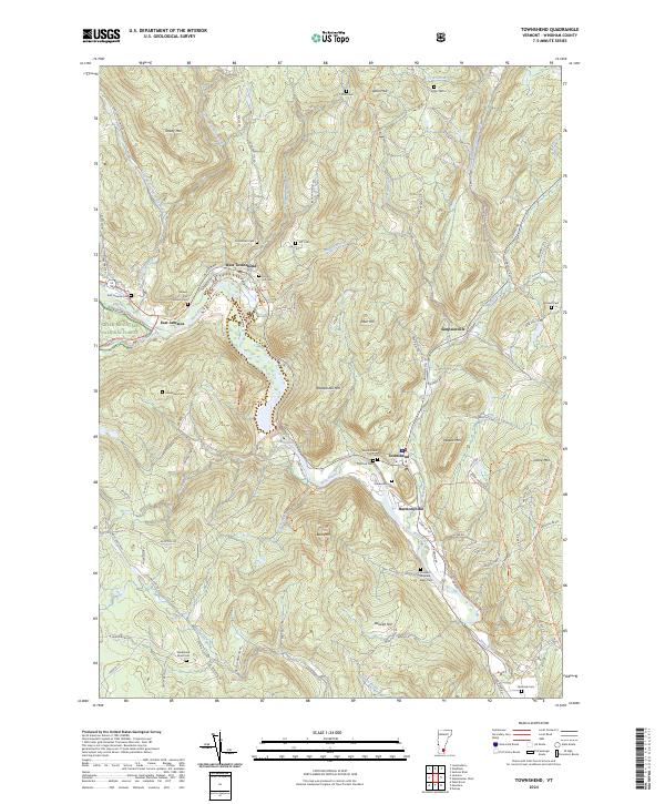
2024 Map of Townshend
USGS Topo · Published 2024About this map
West River carves a deep valley through this Windham County landscape, serving as the primary corridor for settlements like Townshend, West Townshend, and East Jamaica. The topography is defined by significant elevations such as Rattlesnake Mtn, Bald Mtn, and Turkey Mtn, which frame the narrow river basin. This modern survey illustrates how historic land divisions and family names persist through features like the Holland-Brigham-Bixby Cem and Wiswell Cem. The Townshend Reservoir dominates the central valley, a major hydrographic feature that altered the local terrain. A dense network of small brooks, including Acton Brook and Simpson Brook, drains the surrounding uplands into the West River. Portions of the Green Mountain National Forest appear in the western reaches, where the terrain becomes increasingly steep and complex. Numerous small cemeteries, such as Maple Grove Cem and Sanderson Cem, are scattered across the hillsides, providing a clear map of early settlement patterns and genealogical heritage in the region.
Find a feature on this map
96 named features on this map. Tap any name to fly to it.
Don’t see what you’re looking for? This feature index may not catch every label — zoom into the map to look around manually.
Map Details
Editions of this 2024 Townshend Map
This is the sole edition of this map. No revisions or reprints were ever made.
Other maps of this area

1889 · Wilmington
USGS Topo · 1:62,500

1891 · Wilmington
USGS Topo · 1:62,500

1891 · Brattleboro
USGS Topo · 1:62,500

1893 · Brattleboro
USGS Topo · 1:62,500

1894 · Londonderry
USGS Topo · 1:62,500

1899 · Londonderry
USGS Topo · 1:62,500

1899 · Wilmington
USGS Topo · 1:62,500

1930 · Saxtons River
USGS Topo · 1:48,000

1932 · Brattleboro
USGS Topo · 1:48,000

1933 · Saxtons River
USGS Topo · 1:62,500