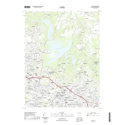
2019 Map of Towson
USGS Topo · Published 2019About this map
Loch Raven Reservoir dominates this landscape, its fingers reaching into the valleys of Dulaney Valley and Towson Run. The area reflects a transition from suburban density to preserved open space and historical estates. The prominent Hampton National Historic Site and the Ridgely Family Cem provide a deep link to the region's 18th-century landholding history. To the east, the NG MTA Gunpowder Military Reserva borders the winding course of Gunpowder Falls, while numerous community-specific burial grounds like Dulaney Valley Memorial Gardens and Moreland Memorial Park serve as local anchors. The map also traces the infrastructure of local aviation and recreation, from the private Albrecht Airstrip to the expansive Pine Ridge Golf Course.
Find a feature on this map
135 named features on this map. Tap any name to fly to it.
Don’t see what you’re looking for? This feature index may not catch every label — zoom into the map to look around manually.
Map Details
Editions of this 2019 Towson Map
This is the sole edition of this map. No revisions or reprints were ever made.
Other maps of this area

1893 · Gunpowder
USGS Topo · 1:62,500

1894 · Baltimore
USGS Topo · 1:62,500

1898 · Tolchester
USGS Topo · 1:125,000

1899 · Baltimore
USGS Topo · 1:62,500

1900 · Parkton
USGS Topo · 1:62,500

1901 · Belair
USGS Topo · 1:62,500

1901 · Gunpowder
USGS Topo · 1:62,500

1902 · Parkton
USGS Topo · 1:62,500

1903 · Tolchester
USGS Topo · 1:125,000

1904 · Baltimore
USGS Topo · 1:62,500