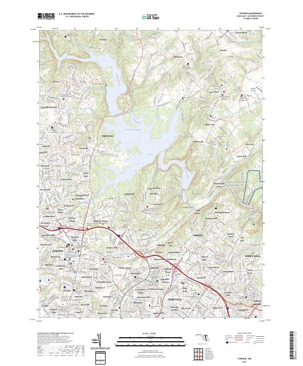
2023 Map of Towson
USGS Topo · Published 2023About this map
Loch Raven Reservoir dominates the central landscape of this Baltimore County region, where the fingers of the Gunpowder Falls meet a suburban-rural interface. The map documents the high density of historical estates and memorial sites, most notably the Hampton National Historic Site and its associated Hampton House Cem. Further north, legacy family holdings are visible through markers like the Merryman Family Cem near Merrymans Mill Rd, reflecting the area's transition from an agrarian and milling economy to an established residential corridor.
Find a feature on this map
388 named features on this map. Tap any name to fly to it.
Don’t see what you’re looking for? This feature index may not catch every label — zoom into the map to look around manually.
Map Details
Editions of this 2023 Towson Map
This is the sole edition of this map. No revisions or reprints were ever made.
Other maps of this area

1893 · Gunpowder
USGS Topo · 1:62,500

1894 · Baltimore
USGS Topo · 1:62,500

1898 · Tolchester
USGS Topo · 1:125,000

1899 · Baltimore
USGS Topo · 1:62,500

1900 · Parkton
USGS Topo · 1:62,500

1901 · Belair
USGS Topo · 1:62,500

1901 · Gunpowder
USGS Topo · 1:62,500

1902 · Parkton
USGS Topo · 1:62,500

1903 · Tolchester
USGS Topo · 1:125,000

1904 · Baltimore
USGS Topo · 1:62,500