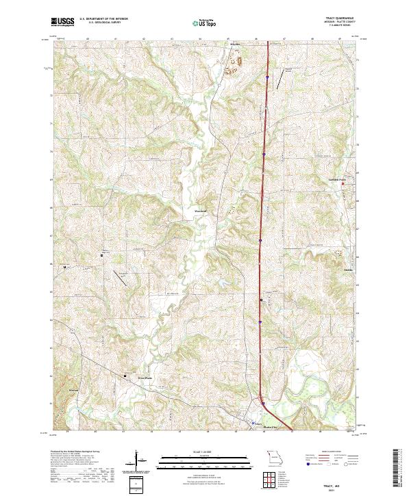
2021 Map of Tracy
USGS Topo · Published 2021About this map
Tracy and Platte City anchor the southern reach of this Platte County landscape, where the meandering Platte River defines the local topography. This modern survey illustrates the dense network of rural roads and aviation points like the Triple R Airport and the Schaback Strip that serve the scattered agricultural communities. For genealogists and local historians, the map preserves the locations of several family and community burial sites, including Wilkerson Cem near West Platte and Kitchen Cem further north. Small settlements such as Woodruff and Camden Point remain as focal points for the surrounding farms. The drainage system is particularly well-defined, showing the numerous branches like Hardesty Br and Jowler Cr that feed into Bee Creek. This survey provides a contemporary perspective on the long-standing land divisions and rural infrastructure of the Missouri heartland.
Find a feature on this map
70 named features on this map. Tap any name to fly to it.
Don’t see what you’re looking for? This feature index may not catch every label — zoom into the map to look around manually.
Map Details
Editions of this 2021 Tracy Map
This is the sole edition of this map. No revisions or reprints were ever made.
Other maps of this area

1890 · Kansas City
USGS Topo · 1:125,000

1894 · Kansas City
USGS Topo · 1:125,000

1910 · Leavenworth
USGS Topo · 1:62,500

1914 · Smithville
USGS Topo · 1:62,500

1925 · Gower
USGS Topo · 1:62,500

1927 · Dearborn
USGS Topo · 1:62,500

1948 · Leavenworth
USGS Topo · 1:62,500

1950 · Kansas City
USGS Topo · 1:250,000
1950 · Ferrelview
USGS Topo · 1:24,000
1950 · Platte City
USGS Topo · 1:24,000